
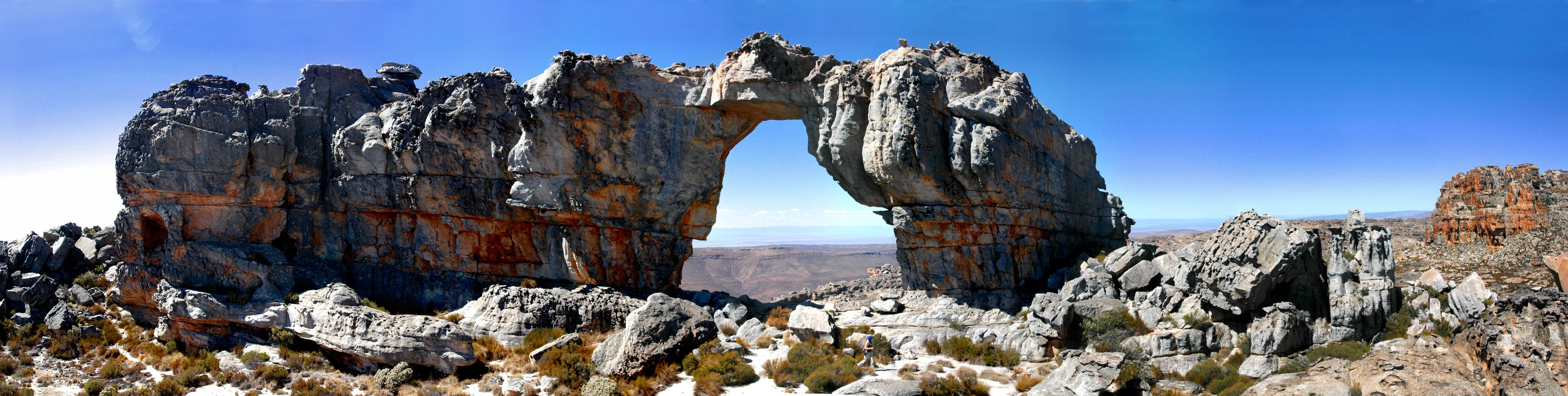
Quick answer: why visit the Cederberg?
The Cederberg is a mountain area in South Africa’s Western Cape, north of Cape Town. Visitors come for its sandstone formations, the hikes to Maltese Cross and Wolfberg Arch, fynbos landscapes and rock art. Plan two to three nights, a vehicle suited to the roads you will use, and walks matched to your experience. Check permits and openings before every outing: several access routes were affected by the 2026 fires and floods, according to CapeNature’s notice of 27 May 2026 (official reserve page).
The Cederberg rewards travellers who leave room for the landscape. The mountains set the pace of the day: a walk in the morning, an unhurried return to your accommodation, then the late-afternoon light reshaping the rock. Choosing a few stops and giving them time works better here than covering long distances.
Where is the Cederberg?
The Cederberg lies in the Western Cape province. Citrusdal and Clanwilliam are useful reference points when planning the approach from Cape Town. CapeNature places the area about 250 kilometres north of Cape Town. This describes its general position, not the exact distance to each place to stay.
It helps to distinguish the mountain range, the protected Cederberg Wilderness Area and the neighbouring private properties. Booking accommodation in the area does not automatically give access to every trail. The starting point, the landowner and the permit conditions determine your route.
When preparing your map, save your accommodation, its reception and the trailhead as three separate points. Places that look close on screen can require different drives. Ask your host which road to take: here, recent local directions are more useful than an unchecked route from a navigation app.
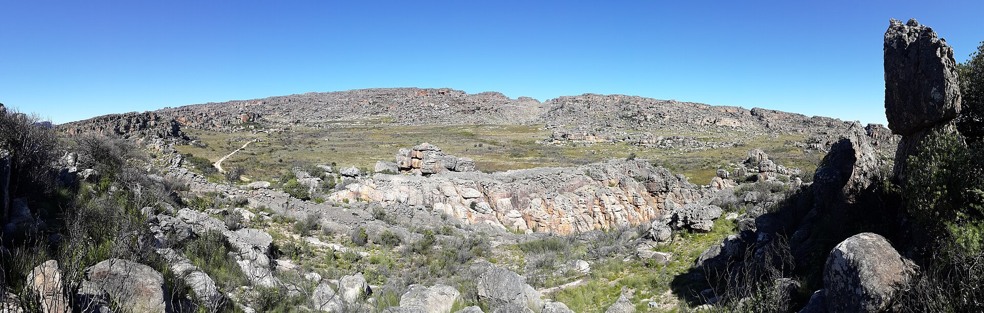
Panorama of the Cederberg mountain reserve — Photo: Lourens van Dyk · CC BY-SA 3.0.

What makes the Cederberg landscape special
The Cederberg combines sandstone mountains, sculpted rock formations and vegetation typical of the Cape Floral Region. Its name refers to the Clanwilliam cedar. Rock art sites add a cultural dimension to exploring the landscape.
For visitors, the appeal is not only about reaching a famous viewpoint. Take time to notice the changing colours of the rock, the outline of a ridge and the details of the terrain. A pause along the trail can be as memorable as the photo taken at the destination.
This way of travelling suits people who enjoy simple days built around one main activity, with few time constraints. If you are mainly looking for city services or a lively evening programme, treat this stop as a nature break within your South African trip.
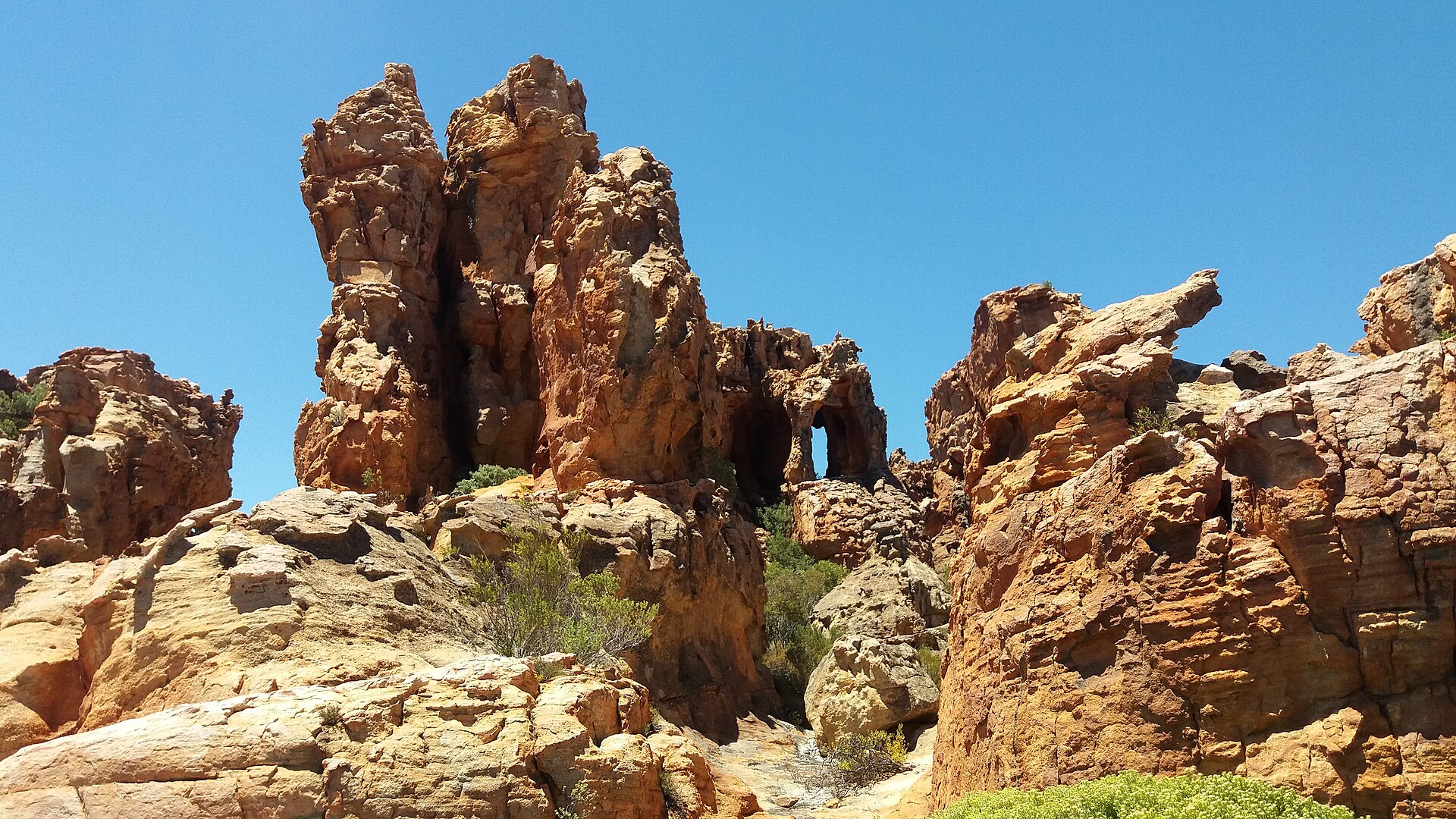
Sandstone formations at the Stadsaal Caves, Cederberg — Photo: Zaian · CC0.
Where to hike in the Cederberg
Four documented routes to consider
CapeNature documents the routes below. Being listed does not guarantee that a trail is open on the day of your visit. Durations are the manager’s estimates; adjust them to your group and the conditions.
| Route | Start or sector | Indicative duration | Difficulty and interest |
|---|---|---|---|
| Maltese Cross | Access to arrange with Sanddrif | 5 hours | Steady climb; return on the same path |
| Wolfberg Arch via Wolfberg Cracks | Sanddrif / Dwarsrivier sector | 8 hours | Demanding; not recommended for beginners |
| Waterfall Trail | Algeria | 3 hours | Moderately steep climb to Middelberg Waterfall |
| Uitkyk Trail | Algeria sector | 3 hours | Short but steep; valley views |
How to choose your hike
Choose a route for the least experienced walker in your group. Distance alone is not enough: a sustained climb, a rocky section or the heat can change the effort considerably. Allow time for breaks and for a slower return than planned.
For a first visit, prefer an outing whose start, route and access are clearly explained by the manager. If your group is torn between two routes, pick the one that leaves more flexibility. A successful hike is also measured by how well the return goes.
Wolfberg Arch deserves a dedicated day. Avoid combining it with a long drive the same morning. The evening before, pack your bags, confirm the permit and agree on a turnaround time suited to the conditions.
Maltese Cross: a classic Cederberg hike
Maltese Cross lets you build a day around an unmistakable rock formation. CapeNature describes a marked trail that climbs and then returns the same way. The route map published by Sanddrif shows a 7-kilometre route.
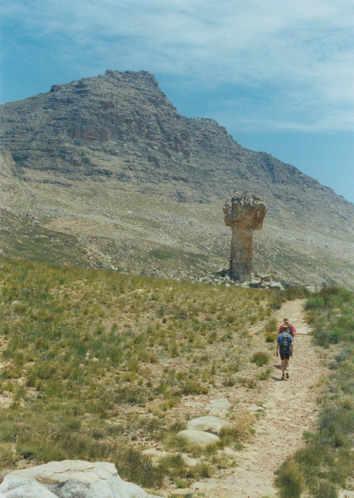
Maltese Cross and Sneeuberg in the Cederberg — Photo: Zaian, public domain — Wikimedia Commons.
Maltese Cross fact sheet
| Information | Key detail |
|---|---|
| Destination | Cederberg, Western Cape, South Africa |
| Start | Maltese Cross trail car park, to be confirmed with Sanddrif |
| Distance | About 7 km for the route shown on the Sanddrif map |
| Type | Out and back |
| Reference time | About 5 hours according to CapeNature |
| Elevation gain | Not stated in the official documents consulted |
| Difficulty | Assess according to the climb, the weather and your fitness |
| Formalities | Permit and access confirmation before setting off |
For elevation gain, ask for a GPS track that matches the car park you will actually use. A figure taken from another start or variant may not describe your day. Also avoid confusing the altitude at the end point with the cumulative ascent: they are different measurements.
On an out-and-back route, memorise landmarks on the way up. A junction can look obvious in one direction and less clear in the other. At the formation, keep enough time and energy for a comfortable descent. Lunch and photos should fit within your return time.
Access to the Cederberg: what to check in 2026
General travel information should be compared with recent notices. CapeNature’s document of 27 May 2026 reports the closure of Uitkyk Pass, restrictions towards Algeria and damage to several roads. It also announces closures of zones B and C until December 2026. Some sites, including Maltese Cross and Wolfberg Arch, were expected to reopen on 1 July, subject to assessments. A past target date does not prove that a site has actually reopened.
Before your trip, ask for recent confirmation of your drive and your hike. If you find two conflicting pieces of information, send both to your host or to CapeNature and ask which applies on your date. Do not assume that an overview page is updated as quickly as an operational notice.
Prepare these questions:
- Is the road to our accommodation open to visitors?
- Which route do you currently recommend?
- Is the chosen trail open from our starting point?
- Where and when do we get the permit?
- Are there any group or return-time restrictions?
Keep the answers offline with your booking. This check avoids turning your arrival into a last-minute search for a detour.
When to go to the Cederberg
The regional climate brings hot, dry summers and cold winters, with most rain falling between May and September. The peaks can see snow, and summer temperatures can reach 40 °C. Conditions differ between the western and eastern sectors.
Spring and autumn: the best periods for hiking
For a hiking-focused trip, consider the southern spring, from September to November, or autumn, from March to May. This choice aims to avoid seasonal extremes; it does not guarantee ideal weather. Then compare forecasts for your dates and the altitude of your route.
Summer: adapt the effort to the heat
Between December and February, keep the programme flexible. A short early-morning outing may be better than a long, exposed hike. If conditions are poor, swap the sporting goal for a quieter day. Booking a stay does not oblige you to complete every planned walk.
Winter: allow more margin
Between June and August, think as much about the return as the start. Shorter days reduce the time available, and a change in the weather can slow the group down. Choose comfortable accommodation for the evenings and keep one day with no essential objective.
How to get to the Cederberg from Cape Town
Start with the exact address of your accommodation. Then ask for the recommended road and a travel time that reflects current conditions. Avoid relying on a single drive time for the whole region.
Sanddrif notes that many access roads are gravel and that a 4×4 is not needed in the usual conditions described on its website. It recommends filling up with fuel before heading into the area and points out that there is no mobile signal on site. Cross-check this general information with recent restrictions.
If you rent a car, check that your contract allows the roads you plan to use. Ask the rental company about breakdown assistance and the recommended vehicle for your route. Aim to arrive in daylight so that access points are easier to find and reception can still be reached.
Download your maps before leaving an area with signal. Keep the written address, the directions from your accommodation and a contact number. A booking that only exists in an online inbox can be hard to find when you need it.
Where to stay in the Cederberg
The best accommodation is the one that simplifies your plans. When comparing two places, look first at their location in relation to your chosen walks, then at comfort, meals and cancellation terms.
Sanddrif offers self-catering cottages and campsites. CapeNature also lists accommodation at Algeria and Kliphuis; check availability against its operational notices.
Self-catering makes early starts easier: you prepare breakfast and your trail lunch at your own pace. Camping requires more organisation, especially for night-time weather and equipment. A comfortable stay can also make sense if your group wants to walk for a few hours and then rest.
Before booking, ask whether meals are available, where to shop before arrival and where to check in. Also check departure times. These details directly affect your hiking day.
How many days to spend in the Cederberg
Two to three nights is a practical recommendation for a first visit. This pace leaves time for one main hike, a shorter activity and adjustments to the programme. It is a planning suggestion, not a duration set by the managers.
Sample three-day stay
- Day 1: drive, check in and confirm local information. Keep the rest of the day light.
- Day 2: main hike, chosen according to openings, weather and the group’s level. Return to the same accommodation.
- Day 3: a shorter outing or a relaxed departure to your next stop.
If you have four or five days, use them mainly for flexibility. A free day lets you wait for better conditions or recover after a demanding walk. It also avoids making the whole stay depend on a single weather window.
What to pack for Cederberg hikes
Pack for the real length of the outing, with a margin for delays. Gear must actually work: a downloaded map should open offline and a head torch needs a charged battery.
- Footwear suited to the terrain and already worn in.
- Sun protection, a hat and sunglasses.
- Water and food matched to the planned effort.
- A warm layer and a wind or rain shell.
- An offline map and a backup navigation option.
- Head torch, power bank and first-aid kit.
- Permit, useful contact details and a bag to carry out your rubbish.
CapeNature requires at least three adults on Cederberg Wilderness trails and sets a maximum group size of twelve. Its activity page bans fires, including gas stoves, in the Wilderness Area. Official rules also prohibit camping at Wolfberg Arch and Maltese Cross.
Tell someone your route and expected return time. Agree on what they should do if they do not hear from you. On the trail, adapt the pace to the group and treat your objective as secondary to the conditions you meet.
Visiting rock art sites with care
The Cederberg can be explored through its heritage as much as through hiking. Rock art visits must follow authorised access. A local guide helps you understand what you are seeing and respect sensitive areas.
Choose a visit where the guidelines are explained beforehand. Look at the paintings from a distance, keep your hands away from the rock and stay on the marked paths. CapeNature rules protect historical and archaeological features and prohibit any damage.
For children, this can be a great moment of observation: spotting shapes, listening to the explanations and asking questions. Avoid presenting every site as freely accessible, though. Ask for confirmation for the specific site you want to visit.
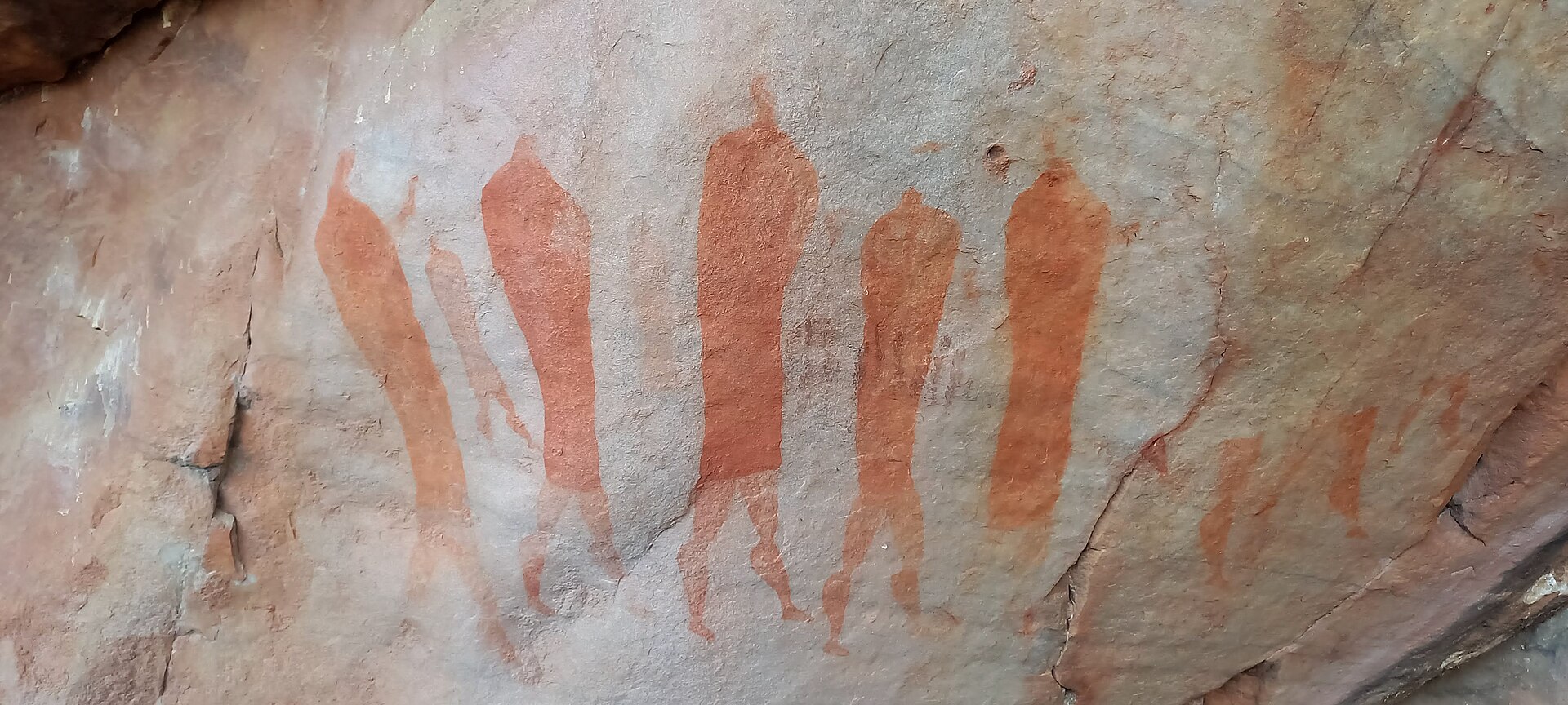
Rock paintings in a sandstone shelter near Stadsaal — Photo: Zaian · CC0.
FAQ: planning a trip to the Cederberg
Where is the Cederberg?
The Cederberg is in South Africa’s Western Cape, north of Cape Town. Citrusdal and Clanwilliam are useful reference points when planning access.
Which hike should I choose for a first visit?
Maltese Cross is worth considering if the route is open and suits your fitness. Have the start, the permit and local conditions confirmed. Wolfberg Arch requires more preparation.
How long is the Maltese Cross hike?
The Sanddrif map shows 7 kilometres for the Maltese Cross route. Check that this distance matches the start authorised for your visit.
Can I hike alone in the Cederberg Wilderness?
CapeNature requires at least three adults on Cederberg Wilderness trails. If you are travelling alone or as a pair, look for a suitable group or guide.
Do I need a 4×4?
Sanddrif states that a 4×4 is not needed in the usual conditions described on its website. For your trip, confirm road conditions, the authorised route and your rental company’s requirements.
Can I camp at Wolfberg Arch?
CapeNature rules prohibit camping at Wolfberg Arch and Maltese Cross. Book authorised accommodation for the night.
Are all hikes open in 2026?
Do not assume so. Official notices report restrictions after the fires and floods. Confirm that both the trail and its access road are open on your date.
Sources and verification
Sources checked on 1 October 2026. The routes are documented; whether they are actually open must be confirmed before you travel. The elevation gain for Maltese Cross still needs to be confirmed from a validated track matching the chosen start.
- CapeNature — Cederberg Wilderness Area: location and overview
- CapeNature — notice after fires and floods, 27 May 2026 (PDF)
- CapeNature — hikes, durations and general conditions
- Sanddrif — route map (PDF)
- Cederberg Conservancy — climate
- Sanddrif — accommodation and practical information
- CapeNature — hiking and overnight rules (PDF)