
Before you set out
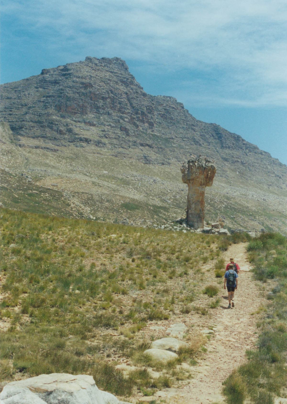
Maltese Cross is a Cederberg rock formation reached on foot. To plan the walk, confirm the permitted trailhead, required permit and access conditions with Sanddrif. The landmark’s name does not identify a single starting point: several approaches exist.
This guide concerns the out-and-back described by CapeNature, with access to arrange on the Dwarsrivier and Sanddrif side. See our Cederberg guide and regional page to place the walk within your trip.
Practical details
| Detail | Planning information |
|---|---|
| Destination | Cederberg, South Africa |
| Format | Out-and-back to Maltese Cross |
| Access | Dwarsrivier / Sanddrif area; confirm the trailhead locally |
| Reference duration | CapeNature lists about 5 hours |
| Another published estimate | The Conservancy lists 2½–3 hours from Dwarsrivier / Sanddrif |
| Distance and elevation gain | Check the exact route and starting point on the selected map |
| Permit | Arrange before departure for the chosen access |
| Walking level | Mountain outing; assess terrain, weather and experience |
Published times are not guaranteed schedules. The descriptions do not provide enough detail to establish that they use identical starting points and include the same breaks. Do not combine one approach’s walking time with another approach’s distance.
Choose your trailhead and prepare the map
Consult the Sanddrif area map, then confirm which starting point is currently available. The area map helps locate the outing; it does not replace a detailed hiking map or instructions from the manager.
Distinguish reception, accommodation and the actual trailhead. Reaching Sanddrif does not mean you are already at the start of the walk. Ask which access track to use, whether your vehicle suits its present condition and how long the drive will take.
Save documents before leaving a reliable connection. A track uploaded by another walker does not establish that their starting point matches yours or that their route is currently permitted. Check the main landmarks and return arrangements before committing the group.
Permits, access and your group
Your permit must match the chosen route and access. Reserve arrangements distinguish day walking from overnight outings, so do not assume an accommodation booking covers the hiking formalities.
Confirm opening, restrictions and permit arrangements before travelling. Fire, maintenance and weather can change access. An old trip report or downloaded map is not confirmation that a route is open on your date.
Plan to walk as a group and confirm the applicable instructions. CapeNature’s Cederberg preparation document recommends at least three people. If your group is smaller or inexperienced, ask about suitable guided arrangements rather than disregarding that advice.
Terrain and the walking day
CapeNature describes an uphill walk on a marked path followed by a return along the same route. That provides a structure, but does not make the ground uniform or navigation automatic. Notice junctions on the outward walk and stay on the permitted route.
Start at a pace that keeps the group together. Adapt breaks to heat, wind and effort. Agree a turnaround time that allows for daylight and the drive back afterwards.
At the formation, allow time to enjoy the surroundings without letting the break undermine your return plan. Walking to Maltese Cross does not require climbing the rock or extending towards a neighbouring summit. Follow the agreed route back.
Season and conditions
Choose the day using local conditions rather than only your travel month. Heat can increase water needs; cold, rain and wind can affect breaks and the journey back. Check the mountain forecast and the manager’s current information.
Discuss a permitted shorter or less exposed alternative locally. Change the programme if access or conditions are unsuitable. A reserve day during a stay of several nights helps avoid making the whole visit depend on one hike.
Equipment and water
Take footwear suited to uneven ground, sun protection, a hat, a warm layer, rain protection, food and water planned for the group and conditions. Do not rely on an assumed refill point along the path.
Add a small first-aid kit, a torch, an offline map and a charged phone. Leave your route and return time with someone reliable. Obtain local emergency contacts before setting out; carrying a phone does not guarantee reception.
Frequently asked questions
Is this suitable for beginners?
Not automatically. Ask about the ground and walking time from your selected trailhead, then compare them with recent walks. A famous landmark is not a suitability assessment.
Should you follow a GPX track?
A track may support planning if it matches the permitted access. It cannot replace the map, permit or local instructions. We do not provide an unverified route file.
Can you add Wolfberg Arch on the same day?
Plan the two walks separately. Do not combine them simply because both appear in the South Africa guide: access, walking time and overall effort must suit the group.