
Quick answer: which walk is this?
GR50 stage 12 links Campo do Gerês with Gerês. The organiser lists 10.3 km, about 4 hours, 458 m of ascent and 740 m of descent, with a difficult rating. This is a linear route: arrange the return before setting out rather than treating it as a village loop.
Use it to plan a walking day in Peneda-Gerês. If you are still choosing a region, start with our guide to where to hike in Portugal.
Stage 12 details
| Detail | Information published by the organiser |
|---|---|
| Route | GR50 stage 12, Campo do Gerês – Gerês |
| Format | Linear |
| Start | Porta do Campo do Gerês |
| Finish | Gerês |
| Distance | 10.3 km |
| Estimated walking time | 4 hours |
| Ascent | 458 m |
| Descent | 740 m |
| Official difficulty | Difficult |
The official stage 12 page provides a map, profile and GPX and KML downloads. Check alerts and current access before your date. These figures apply in the Campo do Gerês to Gerês direction, not to an out-and-back or an improvised variation.
Who should consider this stage?
Choose it if you are used to several hours on walking terrain and your group is comfortable descending. Begin with the official rating: modest altitude does not automatically make a mountain walk easy.
There is more descent than ascent. Consider your comfort downhill, particularly with a loaded bag or wet ground. If your recent walks have been short and on even paths, find a simpler outing first rather than using this stage to test your limits.
Do not calculate the day from mileage alone. Breaks, navigation, ground and weather all affect your pace. Use the published time as a reference and leave a margin for the group.
Arrange access and the journey back
The start and finish are separate places. Before leaving your accommodation, decide how to reach the start and how to leave Gerês afterwards. Confirm a transfer, taxi or public transport operating on your travel day instead of relying on finding something at the last moment.
If using two vehicles, arrange their position without obstructing local access and check authorised parking. A vehicle at the finish does not bring everyone to the start. Note the time you need to meet your transport and save the relevant contacts offline.
Understand the ground without inventing another route
The stage goes through the Junceda area before descending to Gerês. Follow the official map and GR50 markings. A list of viewpoints is not a navigation guide: check junctions against the route document.
Save an offline map and understand the profile before leaving. Follow the manager’s instructions if a diversion is posted. Do not reproduce an older track to bypass a closure or assume an apparently shorter path is a permitted shortcut.
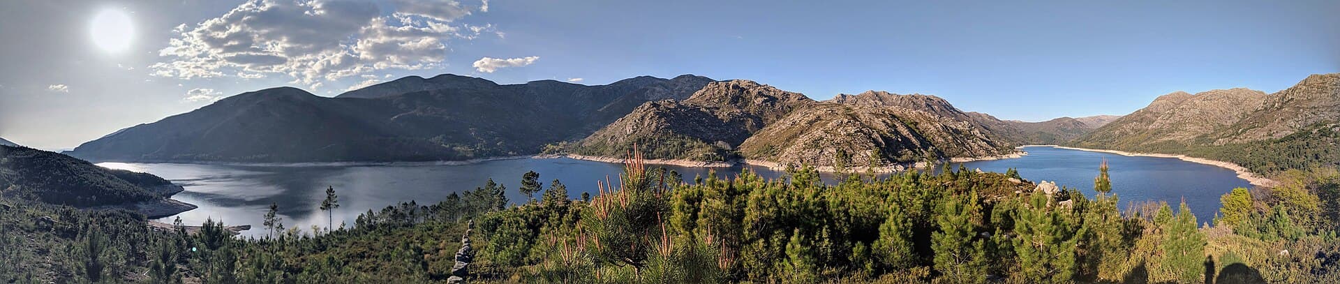
The article photograph places Campo do Gerês and the Rio Homem within the landscape. It does not promise a view from every section of the stage. The official map remains the reference for the actual line of travel.
Season and conditions
The organiser recommends spring and autumn. That is not a weather guarantee for a particular day. Check the local forecast, path information and any restrictions, then adapt to actual visibility and conditions.
Keep the possibility of moving the hike to another day. If you arrive tired or too late to retain a margin, choose a different outing. Driving, settling in and walking all take time: do not plan as though each happens independently.
What should you pack?
Prepare footwear, layers for walking and stops, water, food and protection from sun and rain. Add a light, offline map and appropriate personal items. Our day-hike equipment guide includes a downloadable list for your final check.
Confirm supply opportunities rather than assuming they exist. A place shown on a map may be closed or lack what you need. Transport waiting at the finish does not replace a suitable margin of independence while walking.
Frequently asked questions
Can you make it an out-and-back?
That would be a different day with a different distance and effort. The 10.3 km and 4 hours refer only to the published linear stage, without walking back to the starting point.
Can you walk in the opposite direction?
Do not reuse the ascent and descent figures unchanged. Prepare that direction with a map and confirm access, useful signs and transport. This guide presents the official direction shown in the table.
Where can you get the GPX?
Use the official page linked above. Check that the file is for stage 12 and keep a backup map. A track does not confirm opening or that the route matches your abilities.