
Quick answer: how do you plan a Picos de Europa hiking trip?
For a Picos de Europa hiking trip, pick one base per massif rather than crossing the whole range: Cangas de Onís for the Covadonga lakes, Arenas de Cabrales for the Cares Gorge and Bulnes, and Fuente Dé or Potes on the Cantabrian side. Four to six days let you combine a gorge, a village without a road, a mountain lake and a higher mountain day. In 2026, access to Poncebos and the Covadonga lakes is regulated by bus on certain days, so check the calendar before booking. June to September offers the best conditions, but fog and Atlantic rain remain common.
| At a glance | |
|---|---|
| Where | Picos de Europa National Park (Asturias, Cantabria, León) |
| Bases | Cangas de Onís, Arenas de Cabrales, Potes / Fuente Dé, Caín / Posada de Valdeón |
| Suggested length | 4 to 6 days |
| Season | June to September; May and October depending on snow |
| Plan for | Regulated summer buses, hut bookings, return from linear routes |
| Watch out for | Fog, rockfall on the Cares, livestock guard dogs |
For an overview of the country, see hiking in Spain and our page on the Picos de Europa.
Three massifs: which one should you hike?
Picos de Europa National Park grew out of Spain’s first national park, created in 1918 around the Covadonga mountain. It covers three limestone massifs separated by deep gorges: the Cares and the Duje cut through them from north to south.
| Massif | Highlights | Practical base | Who for |
|---|---|---|---|
| Western (Cornión) | Covadonga lakes, pastures, sea views | Cangas de Onís | First trip, fit families |
| Central (Urrieles) | Naranjo de Bulnes, Torre Cerredo (2,648 m, highest point), Bulnes | Arenas de Cabrales, Sotres | Experienced hikers, rocky ground |
| Eastern (Ándara) | Old mines, quieter summits | Potes, Sotres | Those seeking solitude |
The Cares Gorge: the most famous walk
The Ruta del Cares (PR-AS 229) links Poncebos, in Asturias, with Caín, in the province of León, along a path cut into the cliff above the river. According to Turismo Asturias, the round trip from Poncebos is 22.1 km with about 831 m of cumulative ascent and more than 5 hours of walking; the tourist board rates it “very hard” for its length, despite the low altitude.
The path is about 1.5 m wide in places, above a drop. The tourist board recommends that children be over 12, and that younger ones walk on the inside holding an adult’s hand. Rockfalls regularly close the route: in December 2025 on the León side, then in late July 2026 on the Asturian side, where two hikers were seriously injured before it reopened on 2 August. Check the route status on the day.
In 2026, a transport plan regulates access to Poncebos on certain days (Easter week, early May holidays, May weekends and 1 June to 12 October): buses leave from Arenas de Cabrales, stopping at the Ovar car park, and tickets are booked with the bus company ALSA. For a one-way crossing, a summer bus also links Cangas de Onís with Caín.
Bulnes and the Naranjo de Bulnes
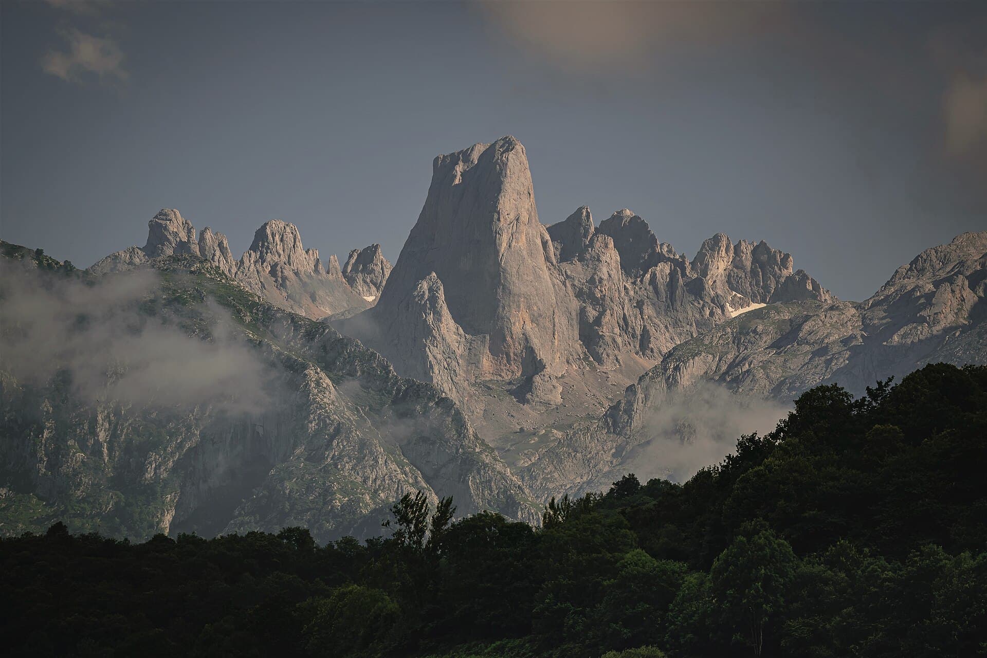
No road reaches the village of Bulnes: you walk up from Poncebos or take a funicular tunnelled through the mountain. Above it, the Naranjo de Bulnes, or Picu Urriellu (2,519 m), raises its vertical wall; its summit is for climbers only.
For hikers, the goal is the Vega de Urriellu hut at the foot of the wall, often reached from the Pandébano pass above Sotres. It is a demanding mountain day on rocky ground: start early and book the hut if you want to stay overnight.
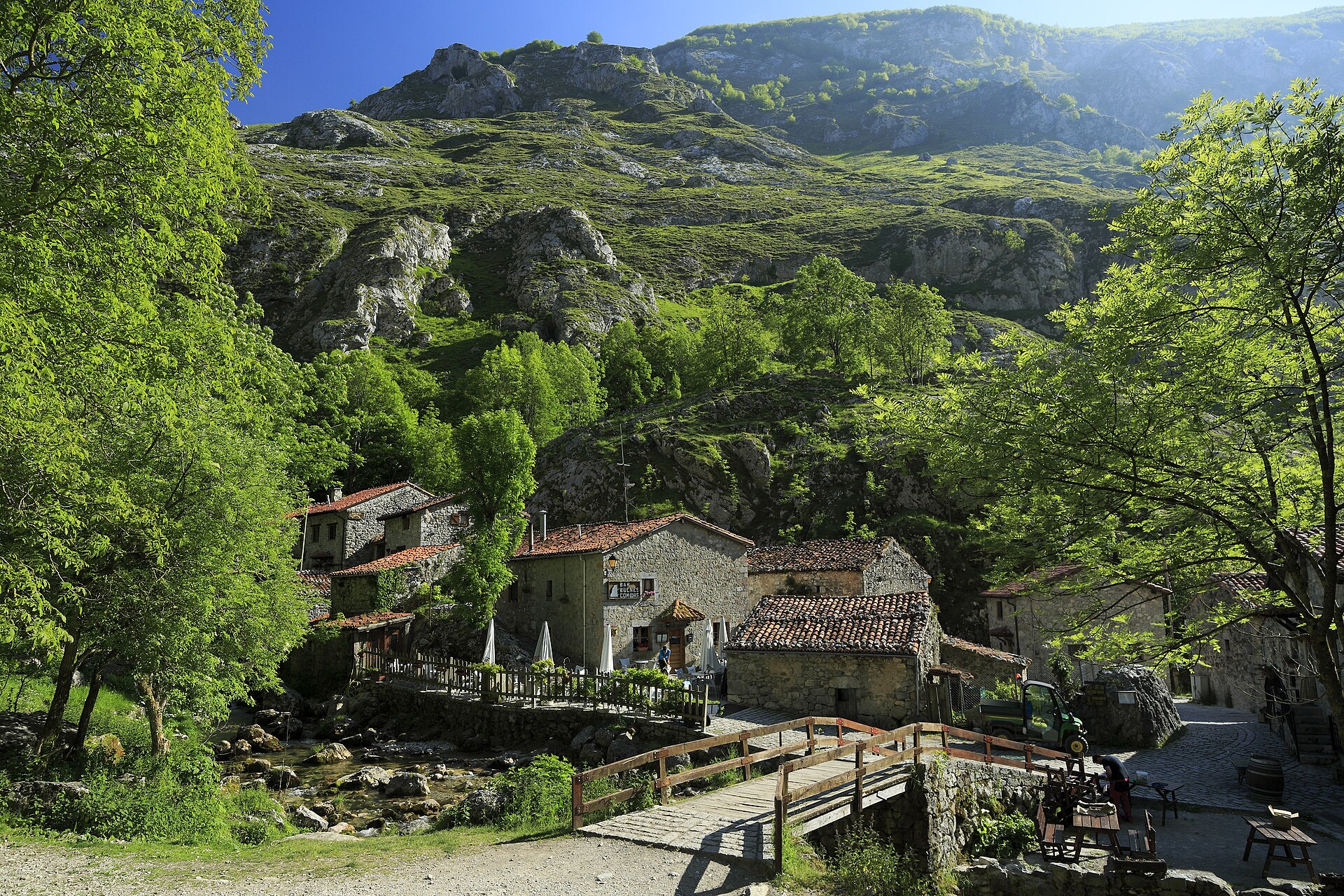
The village of Bulnes, reachable only on foot or by funicular — Photo: Falk2 · CC BY-SA 4.0.
Covadonga lakes: gateway to the western massif
Above the Covadonga shrine, Lake Enol and Lake Ercina are the starting point for several loops through pastures and to viewpoints over the western massif. These walks make a good first day to get used to limestone terrain.
The lakes road is regulated on peak days: private cars are then replaced by buses from Cangas de Onís, and the park can restrict access when car parks approach capacity. Check the year’s calendar on the Turismo Asturias website before planning your day.
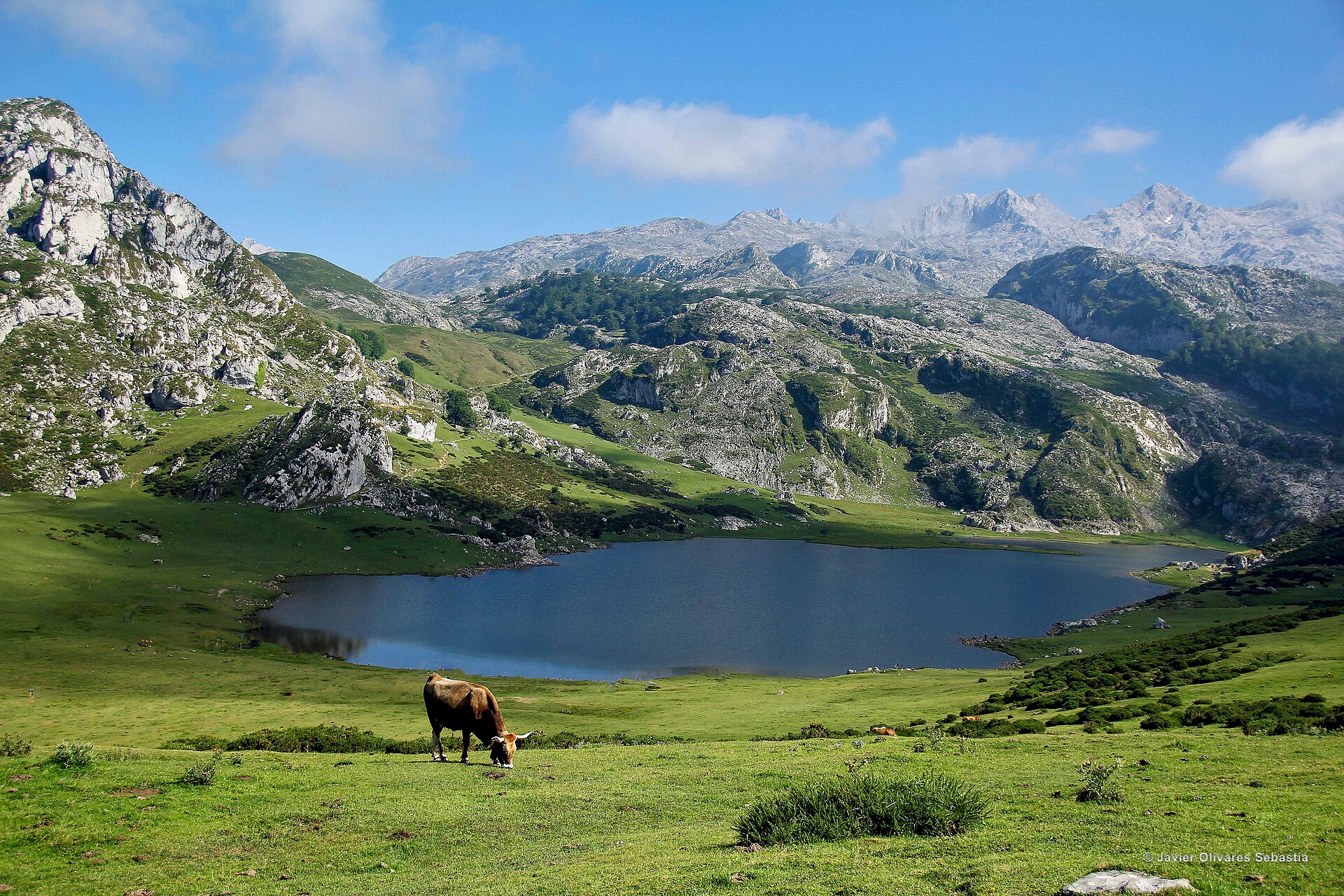
The Covadonga lakes in the western massif — Photo: JavierOlivares · CC BY-SA 4.0.
The Cantabrian side: Fuente Dé and the cable car
In the south-east, the Fuente Dé cable car rises in a few minutes above the wall that closes the Liébana valley. From the upper station, trails cross a high rocky plateau, giving you a high-mountain day without a long initial climb. Potes, a medieval town in the valley, is a practical base.
In summer, the cable car queue can be long: arrive early and check the time of the last descent.
When to go on a Picos de Europa hiking trip
From June to September, high trails are usually free of snow and huts are staffed. July and August are also the busiest months, with regulated access and full car parks. June and September are a good compromise.
The climate is Atlantic: a sea of clouds can fill the valleys while summits are in sunshine, or the reverse. Fog can come down quickly at altitude, where featureless limestone makes navigation hard. Outside the season, snow can linger on the heights from November to May.
Sample five-day trip
- Day 1: arrive in Cangas de Onís, loop around the Covadonga lakes.
- Day 2: hike in the western massif from the lakes.
- Day 3: move to Arenas de Cabrales, Cares Gorge as a round trip or one way with a bus back.
- Day 4: walk up to Bulnes from Poncebos, return on foot or by funicular.
- Day 5: high-mountain day from Pandébano or Fuente Dé, depending on the weather.
This example is not a guaranteed technical itinerary: adapt it to the weather, trail conditions and bus calendar.
Gear, huts and respect
- Shoes with grippy soles: limestone is slippery in the rain.
- Waterproof jacket and warm layer, even in summer.
- Map and offline GPS track: phone signal is missing in the gorges.
- Plenty of water on the Cares: few refill points in summer.
Huts in the Picos should be booked ahead in summer. Herds are often guarded by mastiffs: do not approach or feed them, and keep your dog on a lead.
Frequently asked questions about a Picos de Europa hiking trip
How many days do you need in the Picos de Europa?
Four to six days let you explore the western massif, the Cares Gorge, Bulnes and a higher mountain day without endless driving.
Is the Cares Gorge hard?
It is long rather than technical: 22.1 km round trip from Poncebos according to Turismo Asturias, with sections above a drop. Check that it is open on the day.
Do you need to book the bus to Poncebos or the Covadonga lakes?
On regulated days, yes: buy tickets in advance. The calendar changes every year.
Can you hike up the Naranjo de Bulnes?
No, the summit is a rock climb. Hikers can reach the Vega de Urriellu hut at the foot of the wall.
Which base is best for a first trip?
Cangas de Onís, then Arenas de Cabrales: together they cover the western massif, the Cares Gorge and Bulnes.
Sources
Checked on 10 October 2026: Turismo Asturias, Ruta del Cares; Turismo Asturias, public transport plan for the Cares and Pandébano; Turismo Asturias, Covadonga lakes access; MITECO, Covadonga lakes access regulation; Leonoticias, Cares reopening after the July 2026 rockfall.