
Hiking in Cape Verde
Terraced valleys dropping to the Atlantic, cobbled cliffside paths and a volcanic cone inside a caldera: in Cape Verde, every island offers a different kind of hike.

Hiking places
Routes to explore
- Cova–Paul
- Ponta do Sol–Chã da Igreja
- Pico do Fogo
Quick answer: which island is best for hiking in Cape Verde?
For a first hiking trip in Cape Verde, Santo Antão is the most complete island, with farming valleys, old cobbled paths and coastal trails. Fogo adds the climb of Pico do Fogo, the archipelago’s highest point at 2,829 m, usually done with a local guide from the Chã das Caldeiras caldera. Santiago and São Nicolau offer quieter hikes in mountain natural parks. The driest period runs from roughly November to June; short but sometimes heavy rains fall mainly from August to October.
| At a glance | |
|---|---|
| Where | Santo Antão (bases: Ponta do Sol or Paul), Fogo (Chã das Caldeiras) |
| Who for | Hikers comfortable on steep descents and cobbles |
| When | Roughly November to June |
| Suggested length | 3 to 5 days on Santo Antão, 2 days on Fogo |
| Plan for | Ferry or flight between islands, shared taxis, guide for Pico do Fogo |
| Watch out for | Slippery descents, heat, flash floods after rain |
Where to go hiking in Cape Verde
The archipelago has ten islands, but four account for most hiking. Santo Antão, in the north-west, is the most mountainous and the greenest. Fogo is an active volcano. Santiago, home to the capital Praia, and São Nicolau add less-visited ranges.
Flat, sandy islands such as Sal and Boa Vista have little mountain hiking. If you land on Sal, build the connection to São Vicente or Santiago into your plan.
Choosing your island for hiking in Cape Verde
Santo Antão: valleys, ridges and coastal paths
Santo Antão is reached by ferry from Mindelo, on São Vicente, to the port of Porto Novo. The deeply cut north-east of the island holds the best-known trails. The descent from the Cova crater into the Paul valley is the classic hike: a long cobbled path dropping through terraced fields to the coast. The Cova crater, the Paul valley and Ribeira da Torre have been on UNESCO’s World Heritage tentative list since 2016.
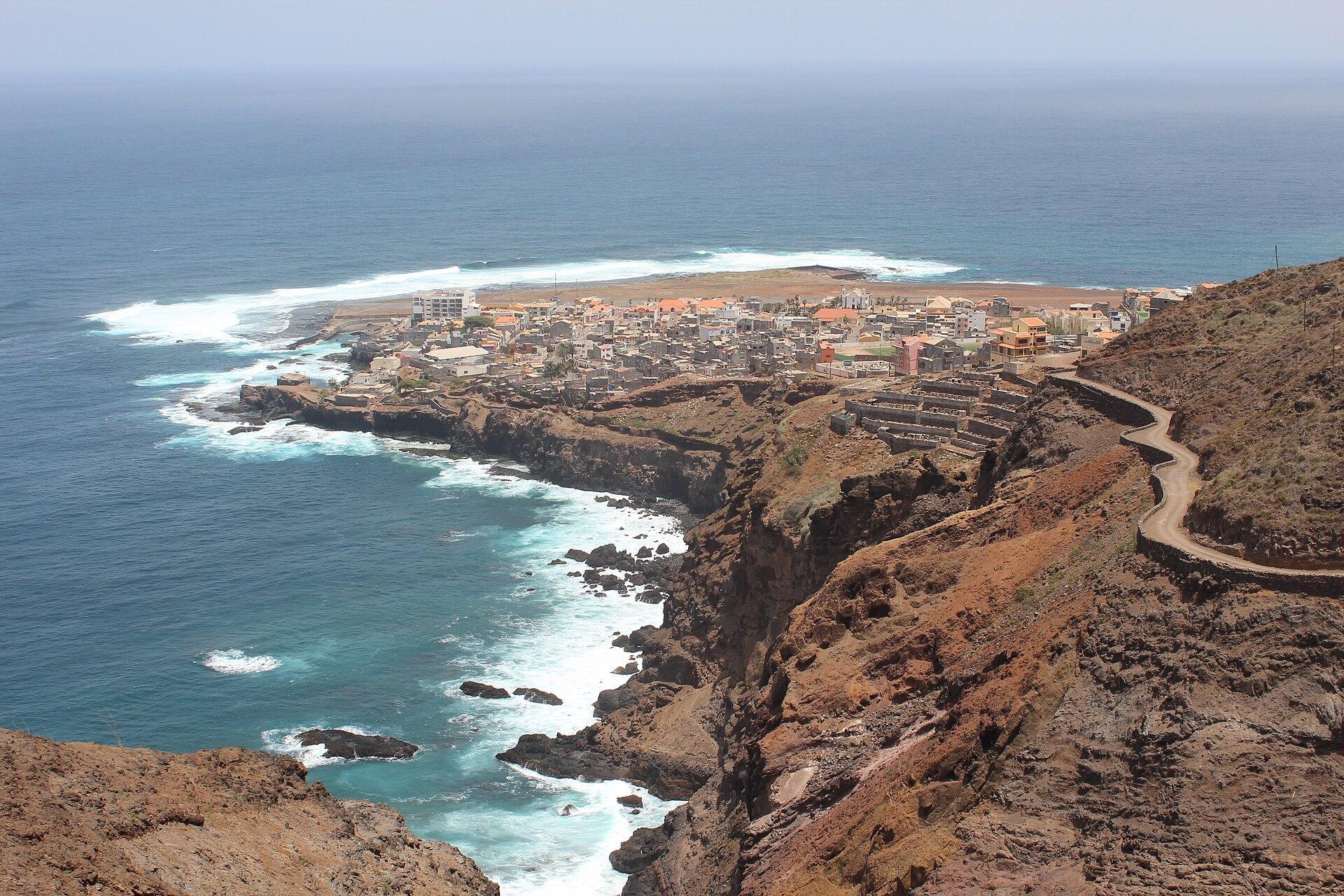
On the coast, the path from Ponta do Sol to Fontainhas and on to Cruzinha follows cliffs above the ocean, with exposed sections where a head for heights helps. Ponta do Sol and the Paul valley make the most practical bases.
Practical tip: descending paths are paved with smooth stones that turn slippery after a shower or in morning dew. Grippy soles and trekking poles make a real difference.
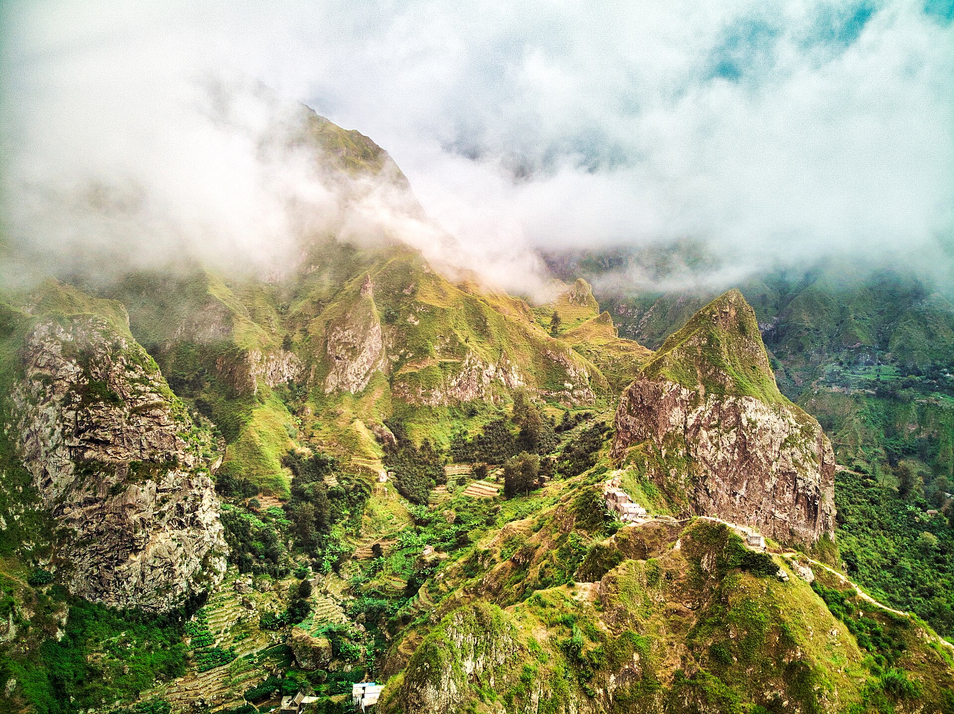
The Paul valley on Santo Antão — Photo: CaptainDarwin · CC BY-SA 4.0.
Fogo: climbing Pico do Fogo
Pico do Fogo rises to 2,829 m from the middle of Chã das Caldeiras, a large inhabited caldera. The climb from the caldera floor gains about 1,000 m on ash and cinders. Many hikers descend by sliding down the ash, which is why high-top boots are useful.
The volcano is active: its latest eruption began on 23 November 2014 and ended on 8 February 2015, destroying much of the caldera villages, including Portela. Local information states that the climb is done with a guide; ask at the natural park centre or your guesthouse in Chã das Caldeiras.
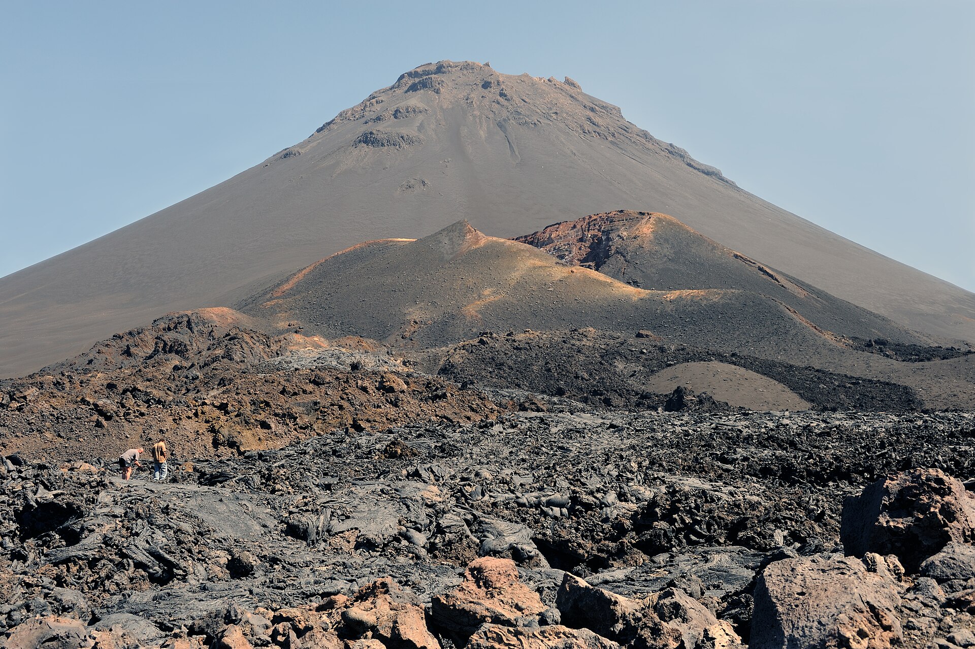
Pico do Fogo and its secondary cone — Photo: Cayambe · CC BY-SA 3.0.
Santiago and São Nicolau: quieter mountains
On Santiago, Serra Malagueta Natural Park has high trails above the valleys of the island’s north. It is a good choice if you arrive in Praia with little time. On São Nicolau, Monte Gordo Natural Park links ridges and villages.
Both islands see fewer hikers than Santo Antão, and transport and trail information are more limited. Arrange your walk through your guesthouse or a local guide.
When to go hiking in Cape Verde
The climate is dry and warm for much of the year, cooled by the trade winds. The most pleasant hiking period runs from about November to June. Rain varies from year to year and falls mainly from August to October; it can wash out paths and cause flash floods in the ribeiras (valleys).
On the heights of Santo Antão and Fogo, cloud and wind make the air much cooler. Pack a warm layer for summits even when the coast is hot.
To compare with other destinations, see our month-by-month calendar of the best time to go hiking.
Transport and logistics
- Between islands: ferry from Mindelo (São Vicente) to Porto Novo (Santo Antão); domestic flights to Fogo, Santiago and São Nicolau. Check timetables, which change with the season and sea conditions.
- On the islands: aluguers (shared minibuses) serve the villages; book a ride to the Cova trailhead the day before.
- Linear routes: most of the major hikes are not loops, so plan your return before you start.
- Guide: recommended on poorly marked trails and expected for Pico do Fogo.
Gear and safety
Carry plenty of water, as refills are rare on some stretches. Bring a hat, sunscreen, shoes with good grip and a windproof jacket. Stay out of ribeira beds during heavy rain.
Terraced trails cross farmland and villages: stay on the path, close gates and leave crops alone.
Frequently asked questions about hiking in Cape Verde
Which is the best island for hiking in Cape Verde?
Santo Antão, for the variety of its valleys and coastal trails. Fogo is a good addition for the volcano climb.
Do I need a guide for Pico do Fogo?
Local information states that the climb is done with a guide. The ash terrain and route-finding near the top justify one anyway.
Can I hike without a car?
Yes, using aluguers and taxis. Schedules are irregular, so book transport to remote trailheads such as the Cova crater.
When should I avoid hiking in Cape Verde?
During the August to October rains, paths and roads can be damaged in some years. Check conditions locally.
How many days should I spend on Santo Antão?
Three to five days let you walk the Paul valley, the Ponta do Sol coastal path and another valley, adjusted to your group’s pace.
Sources
Checked on 10 October 2026: UNESCO tentative list, Cova, Paul and Ribeira da Torre Natural Park; USGS, the Fogo eruption; UK FCDO, Cape Verde travel advice.