
Hiking in Indonesia
Crater lakes, volcano sunrises and tropical forest: in Indonesia, most hikes take place on active volcanoes, with access rules to check before every outing.
Hiking places
Routes to explore
- Rinjani
- Bromo
- Ijen
- Batur, accès volcaniques à vérifier
Hiking guides
Where to hike in Indonesia
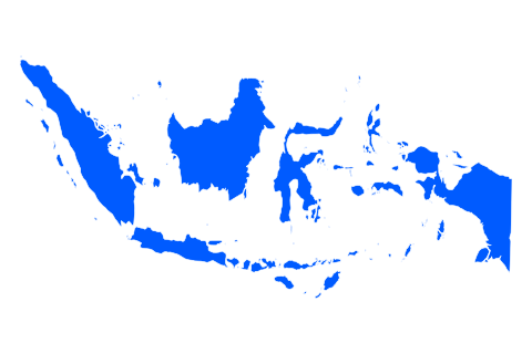
Indonesia has thousands of islands and many active volcanoes. For hiking, four islands account for most trips: Lombok and Mount Rinjani, Java with Bromo and Ijen, Bali with Mount Batur, and Flores with the Kelimutu lakes.
Most of these hikes are on volcanoes. Access depends on the volcanic alert level, which can close a trail or crater overnight. Before each outing, check the park’s announcements and the alert level published by the Indonesian authorities.
Four islands to choose your hike
Lombok: the Mount Rinjani trek
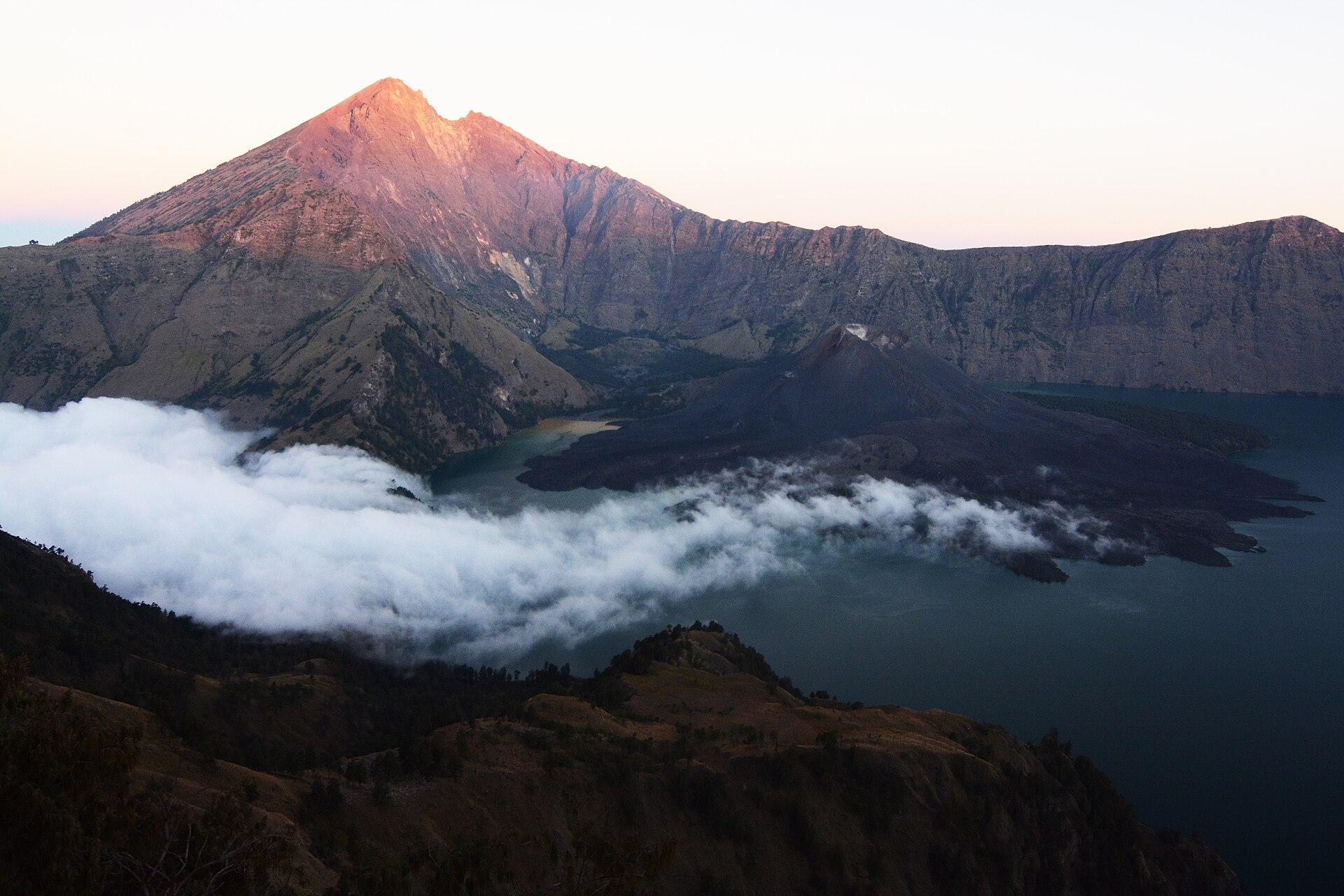
Mount Rinjani, on Lombok, rises to 3,726 m. Its crater holds Segara Anak lake and a young volcanic cone. The classic trek takes two to four days, with nights camping on the crater rim, and the climbs are steep and dusty.
Routes, booking and park closures are covered in our guide to planning the Rinjani trek.
Entry to Gunung Rinjani National Park requires an online booking on the official e-Rinjani platform, with a ticket to show at the gate. For foreign visitors, park regulations require trekking with a licensed guide, usually with porters. The park closes its trails for part of the rainy season, so check opening dates before booking.
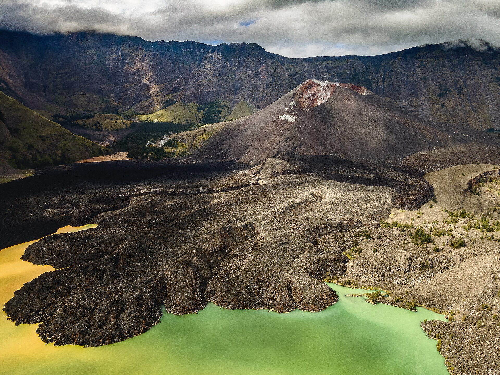
Segara Anak lake in the crater of Mount Rinjani — Photo: Arimasfiras · CC BY-SA 4.0.
Java: Bromo and Ijen
In eastern Java, Bromo rises from a vast sand-covered caldera in Bromo Tengger Semeru National Park. Visitors often arrive before dawn to watch the sunrise from a viewpoint, then climb steps to the crater rim. Further east, Ijen is known for its acidic lake and fumaroles.
At Ijen, volcanic gases can be irritating or dangerous: a suitable mask is recommended and crater access may be restricted depending on emissions. For both volcanoes, check opening hours and any closures linked to volcanic activity.
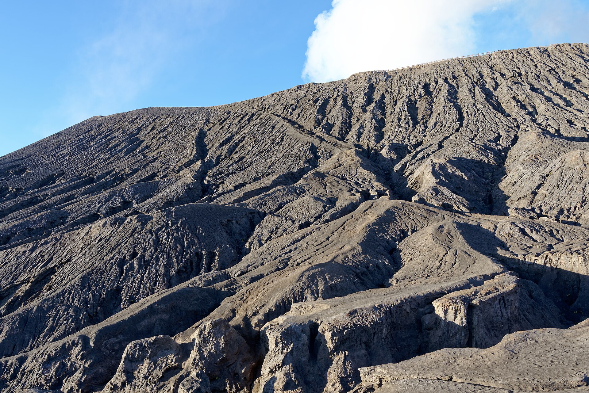
The slopes of Bromo in eastern Java — Photo: Jakub Hałun · CC BY-SA 4.0.
Bali: Mount Batur at sunrise
In north-east Bali, Mount Batur is usually climbed at night to reach the summit for sunrise. The ascent generally takes a few hours from the foot of the volcano. It suits fit walkers, but the path is steep, sandy and busy.
Climbs are usually organised with a local guide. Bring a head torch and a warm layer: it is cool at the summit before dawn.
Flores: the Kelimutu lakes
On Flores, Kelimutu is famous for its three crater lakes, whose colours change over time. A short walk from the car park leads to the viewpoints, making it an easy outing. Sunrise is often the best time, before the clouds roll in.
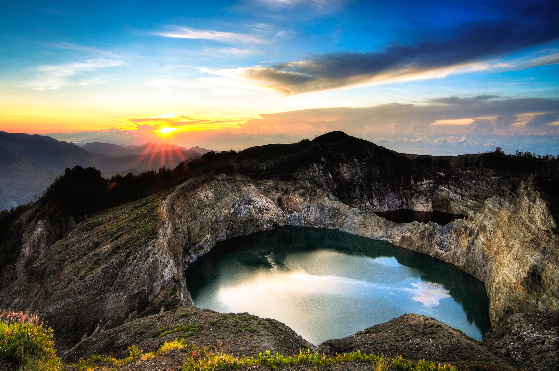
The Kelimutu lakes at sunrise on Flores — Photo: Bagus Pinandoyo Basuki · CC BY-SA 4.0.
When to go hiking in Indonesia
The dry season, roughly April or May to October, is best for hiking the volcanoes of Java, Bali, Lombok and Flores. In the rainy season, trails become slippery, visibility drops and some parks, such as Rinjani, close for part of the year.
Exact dates vary by island and year. Check trail openings and local weather before fixing your trip.
To compare with other destinations, see our month-by-month calendar of the best time to go hiking.
Permits, guides and organisation
- Booking: an e-Rinjani ticket for Mount Rinjani; entrance fees for other national parks.
- Guide: mandatory for foreigners on Rinjani and customary on Batur; recommended at Ijen.
- Volcanoes: check the alert level and exclusion zones before each outing.
- Transport: domestic flights between islands, then a drive to the trailhead; starts are often in the middle of the night for sunrise.
Compare agency offers with equivalent services: permits, guide, porters, tents, meals and transfers are not always included.
Gear and safety
Bring good hiking boots, a head torch, a warm layer and a windproof jacket for the summits, sun protection and plenty of water. On sandy trails, gaiters and poles help on the descent. At Ijen, a gas mask is recommended.
Respect bans on entering craters: they protect against gases and explosions. Carry out your rubbish, a real problem on the busiest trails.
Frequently asked questions about hiking in Indonesia
Do I need a guide for Mount Rinjani?
Yes for foreign visitors: park regulations require a licensed guide, and bookings go through the e-Rinjani platform. Porters usually accompany groups.
Which hike is best for beginners?
Kelimutu and Bromo can be reached with a short walk. Batur requires a few hours of steep climbing. Rinjani is a demanding multi-day trek.
Can volcanoes be closed?
Yes. Access depends on the volcanic alert level and can change quickly. Check official information before each outing.
When is the best season?
The dry season, roughly April or May to October. Rinjani closes for part of the rainy season.